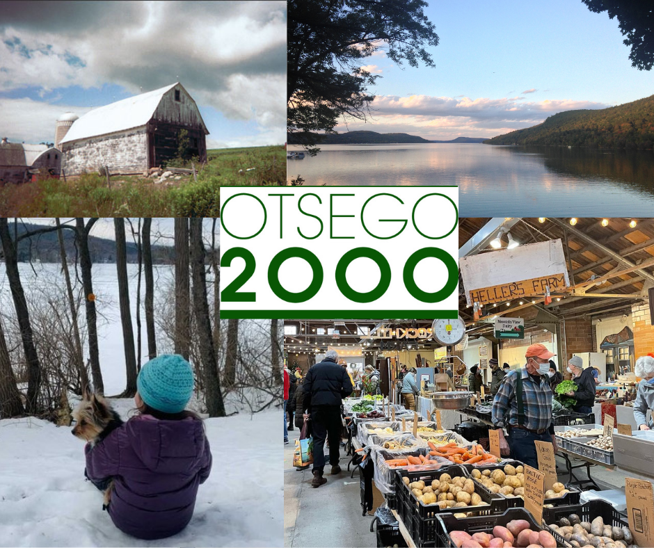
Otsego 2000 views our environment as highly interconnected and interactive; agriculture, economics, land-use planning, town planning, and historic or cultural preservation all contribute to the quality of where we live and are critical to ensuring the health of Otsego County.
While we believe growth and change are both desirable and inevitable, our task is to try to guide proposed changes and additions along what we hope are more intelligent pathways. While Otsego Lake is the centerpiece, we are just as concerned with its surroundings, natural and human. All are inseparable. Otsego 2000’s environmental stewardship work focuses on protecting the Otsego region’s rural and agricultural landscapes from harmful development, rural sprawl, and large-scale industrialization that would negatively affect air, water, and soil quality, as well as disrupt our rural character and quality of life.
Development and Infrastructure Projects Affecting Otsego County
A municipality’s comprehensive plans and land use regulations are essential to ensuring that our communities’ development reflects the desires of those who live and work in the towns. Nearly every town and village in Otsego County have comprehensive plans that informed the development of their zoning and subdivision regulations, and without civic engagement by the citizens of each town to ensure development occurs in accordance with those plans, we stand to lose our community character and in the process, could irretrievably harm our environment.


Lake Otsego Properties (Manocherian Subdivision) Proposal, Towns of Springfield and Otsego
NEW: Manocherian Developers Submit “Conservation Package” Sketch Plan
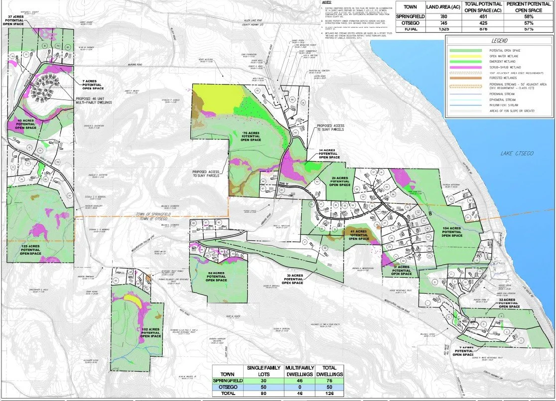
On May 19, 2026, developers submitted a new sketch plan for the 1,525 acres of farmland, open space, steep slopes and wetlands on the western slope of Otsego Lake in the towns of Otsego and Springfield. Changes to the sketch plan from the 2025 version include:
increase in buildable lots from 111 (2025) to 126. This was done largely in what was called Neighborhood 6 (Buddle-McRorie Roads), and doubles the number buildable lots but triples the number of dwellings due to 23 two-family lots.
reduces the number of buildable lots in what was Neighborhood 1, adding ‘potential open space’ closer to Rte 80.
Decreases the length of new roads from 3 miles to 1.78 miles through use of dead-ends or cul-de-sacs.
Shifts the main entrance into the subdivision from State Route 80 to Thurston Hill Road.
The “potential open space” appears to be overwhelmingly the steep slopes and wetlands, which are not buildable anyway.
As revised, this project would still potentially negatively affect Otsego Lake water quality, State Route 80, the Glimmerglass Historic District, SUNY Biological Field Station’s Thayer Farm campus, as well as Vibbard, Wedderspoon Hollow, McCrorie, Buddle, Red House Hill and Thurston Hill Roads.
2025 Sketch Plan
1,525 acres of farmland, open space, steep slopes and wetlands on the west side of Otsego Lake
111 4.5 acre - 60 acres buildable lots to be created through a major subdivision
Town of Otsego—765 acres subdivided into 59 buildable lots; 1.9 miles new road
Town of Springfield—760 acres subdivided into 52 buildable lots; 1.1 miles new road
The property owners’ representatives presented the project in a sketch plan conference to the Otsego and Springfield Town Planning Boards in August 2025. Because they did not return within six months with a formal application and plats to each town planning board, they are obligated to begin the process again with a new sketch plan conference.
To receive updates and reminders on town meetings, send us your email.
Be Informed.
Town Meeting Schedule
Town of Otsego Planning Board meets the 1st Tuesday of the month at 7:30 PM
Town of Otsego Board meets the 2nd Wednesday of the month at 7 PM
Town of Springfield Planning Board meets the 1st Thursday of the month at 7 PM
Town of Springfield Board meets the 2nd Monday of the month at 7 PM
Constitution Pipeline
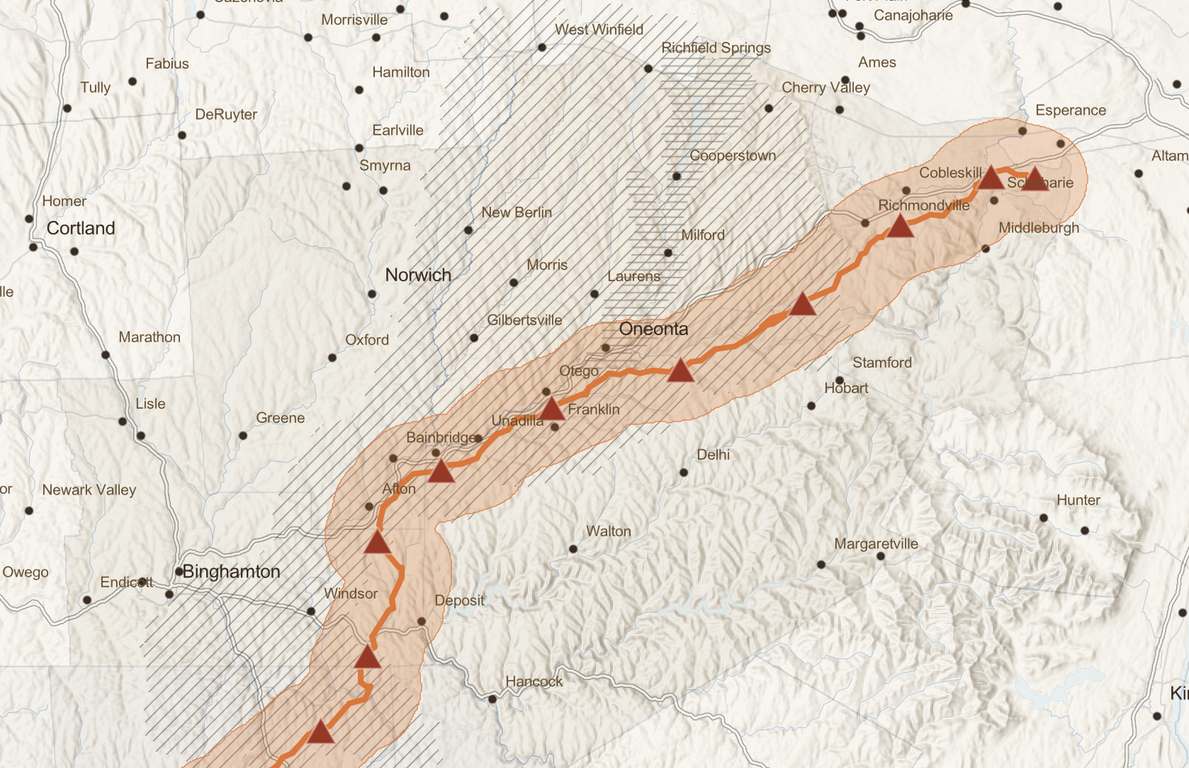
The current federal government’s support of fossil fuels over renewable energy has led to the resurrection of the Williams Company’s Constitution Pipeline, which is slated to run 125 miles from Susquehanna, PA through the western Catskills to the Wright compressor station on Route 20 in Schoharie County, NY.
Running on the ridges of the western edge of Delaware County, the pipeline would cross hundreds of trout streams and clear swaths of forest. What makes this even more concerning is that Williams Company now advertises its strategy to build natural gas power plants along its pipeline routes to provide energy for hyperscale data centers (Meta is its first customer, in Ohio).
If permitted by the Federal Energy Regulatory Commission, it would open the door to construction and siting of data centers and power plants along its route. This would pollute our air, streams and rivers, including the Susquehanna, and destroy the rural landscapes and livelihoods that we cherish while driving up ratepayers’ energy costs.
Click on the Constitution Pipeline Impacts StoryMap at left to learn more and what you can do.


Pipeline = Data Centers?
What Towns Can Do to Protect Communities
In 2025, the Town of Oneonta found itself confronted with a proposal for a data center on a former horse farm in its Residential Ag zoning district. The founders of EcoYotta, Inc., a brand-new startup, purchased a 150-acre horse farm in the Town of Oneonta’s RA-40 zoning district and petitioned the Town to change the zoning for the parcel to allow data centers and research centers. After significant public outcry, EcoYotta withdrew its application and returned later with a new proposal for a hydroponic farm heated by the waste heat from data servers. The public and town boards were skeptical, and EcoYotta retreated once again. .If allowed, a data center in this zone (or any zone) would certainly and negatively affect the town, as well as surrounding areas and the Susquehanna River.
While the EcoYotta application was playing out, the Constitution Pipeline re-emerged as a threat to the region’s forests and waterways. In 2014, hyperscale data centers did not exist; today, their rapid proliferation has led to exponential increases in energy bills across the country, and locally where they are sited, spikes in air pollution and noise, strain on water resources and water quality.
What Can We Do?
There are numerous ways citizens can fight back.
Press your town board to enact a moratorium on data centers to allow time for updating the comprehensive plan and ensuring the town’s land use law regulates whether, where, and how data centers can be sited. A municipality’s comprehensive plans and land use regulations are critical to ensuring that their community’s development reflects the desires of those who live and work in the towns.
In 2026, the Town of Oneonta became the first in New York State to enact a moratorium on data center construction. More towns need to follow suit while there is still time.
Call or write Governor Hochul and your state representatives to demand that the data center construction moratorium legislation be signed into law so that the Department of Environmental Conservation (DEC) has time to develop stringent regulations on data center construction in New York State.
Participate in all public hearings and public comment periods; mail or email comments on proposed projects.
Comprehensive plans inform the development of zoning regulations, and without civic engagement by the citizens of each town, we stand to lose our community character and irretrievably harm our environment.
Be Informed.
The City of Oneonta Common Council meets the first and third Tuesdays of each month at 7:00 pm.
The City of Oneonta Planning Commission meets the third Wednesday of each month, at 7:00 p.m., in the Common Council Chambers.
The Town of Oneonta Planning Board meets the 1st & 3rd Monday of every month at 7:00 pm.
-
Event Materials and Q&A from October 16 program at the Village Library of Cooperstown
-
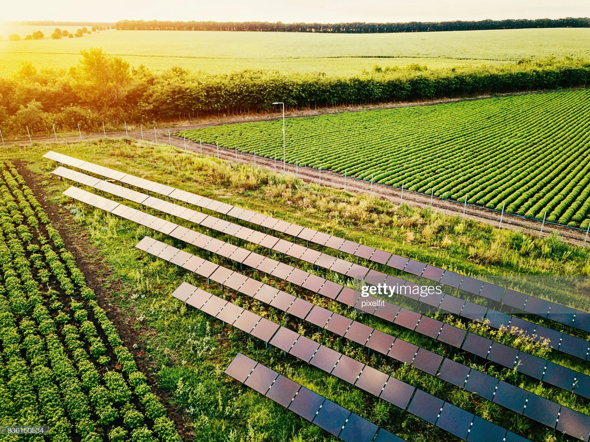
We call for energy conservation to reduce reliance on fossil fuels. We strongly support solar energy development that is compatible with our agricultural resources and environment.
OTSEGO 2000 POSITION ON SOLAR AND RENEWABLE ENERGY
Adopted February 24, 2018Otsego 2000 is a non-profit organization dedicated to protecting the historic, environmental, cultural, and agricultural resources of Otsego County and the greater Otsego Lake region. We support and offer informed advocacy, intelligent planning, public education, and sustainable economic alternatives, all in service of the long-term economic well-being and the quality of life of our residents.
Climate change, driven in large part by fossil fuel use, is a significant threat to our region and way of life. We call for and support energy conservation and efficiency to reduce reliance on fossil fuels and the necessity for expanded fossil fuel infrastructure and delivery systems. In addition, we call for and support smart development of renewable energy sources to meet the goals adopted by New York State for greenhouse gas reductions.
We strongly support solar energy development compatible with our agricultural resources and environment, including community solar facilities for local benefit. We encourage commercial, residential, and agricultural property owners to shift to rooftop or freestanding solar arrays to reduce or eliminate fossil fuel use. We encourage eligible property owners to take advantage of financial incentives such as those offered by the New York State Energy Research Authority (NYSERDA) and applicable historic preservation tax credits in connection with such installations.
To this end, we support development of solar installations that:
Prioritize previously disturbed or degraded areas, such as landfills, brownfields, impervious surfaces.
Protect agricultural lands and offer co-location of agriculture with solar power installations.
Protect our historic, cultural, and scenic resources.
Maintain conserved lands, whether for ecological or agricultural purposes.
We also support residential, commercial and community development of geothermal, wind and other renewable energy sources, guided by similar considerations.
-
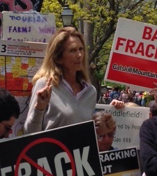
In 2008, Otsego 2000 began a long campaign to educate state and local leaders and citizens about the adverse and irreversible impacts of natural gas hydraulic fracturing, or fracking. Among the first statewide to raise the alarm, we felt strongly that the draft New York DEC guidelines governing shale gas extraction in Otsego County, and elsewhere in New York, posed unacceptable risks to our water, environment, agriculture, health and infrastructure. They failed to safeguard our drinking water supplies and air quality, did not take into account considerable seismic activity, did not protect the fragile historic heritage of our communities, and did not provide the means for local and county governments to protect existing infrastructure from the onslaught of heavy truck traffic, the upgrade of emergency response training, or the effective treatment and disposal of fracking wastewater. Most alarmingly, there had been no comprehensive study of the cumulative impacts of shale gas extraction either on the environment or on human and animal health. Until such data are available, and until shale gas extraction can be proven harmless to the climate, environment and human and animal health, Otsego 2000 supports a ban on hydraulic fracturing and related activity – waste disposal/storage, transport, etc. -- in New York State.
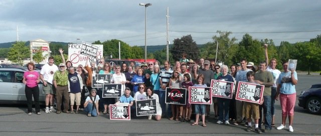
To this end, Otsego 2000 led the State in organizing communities to enact bans on heavy industry, including shale gas extraction, and push the State for stringent regulations, organizing neighborhood groups and supporting Home Rule -- the right of local communities to determine their community character through control over land-use decisions. Most recently, for example, Otsego 2000 established the Middlefield Legal Defense Fund to hold monies that were contributed to assist the Town of Middlefield in its lawsuit, Cooperstown Holstein vs. Town of Middlefield. That lawsuit ended with a ruling by the New York State Court of Appeals, in June 2014, upholding the town’s right of Home Rule. Subsequently, over 100 towns and villages in New York have banned fracking. Otsego 2000 also pioneered the highly successful comment letter template system which enabled ordinary concerned citizens to voice their concerns quickly and efficiently during often tight public comment periods. Working with local experts, 20 different comment letters were drafted for people to adapt and send. This system, also adopted by New Yorkers Against Fracking, Catskill Mountain Keeper and other organizations, led to an exponential rise in the number of public comments received, from 1,000 on the first draft SGEIS to over 200,000 on the revised draft SGEIS. It also was a highly effective educational tool as the details in the draft letters were circulated to a wide audience. At the same time, organizing such an overwhelming response to the draft SGEIS bought time for the ongoing environmental and health impact studies in other states to begin to show results.
On December 17, 2014, the State announced that a ban would be instituted based on the emerging science and impacts in states where fracking was permitted. In June 2015, in a Findings Statement on high-volume hydrofracking (HVHF), the NYS DEC announced that it had found no feasible or prudent alternatives that would adequately avoid or minimize adverse environmental impacts, and that would address the scientific uncertainties and risks to public health from this activity. To that end, the NYS DEC recommended a “No-Action alternative,” prohibiting HVHF in New York State. The statement noted the challenges in protecting special places, such as Otsego County's nearly 35,000 acres of National Register or National Register-eligible historic districts, from negative impacts associated with fracking. Despite these significant achievements, Otsego 2000’s campaign against this method of shale gas extraction and the transport pipelines and compressor stations that may crisscross the state will continue until a safe alternative is discovered.